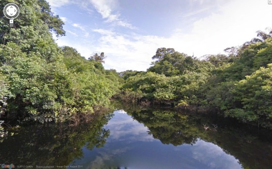
Google Adds Amazon Rainforest to Street View
Back in August of 2011, Google began mapping the Amazon Rainforest for their ever-growing Street View feature within Google Maps. Now, Google has released the fruits of their rainforest labor, as the bits of the rainforest they explored are available for you to explore on Google Street View.
Obviously, Google did not map the entire Amazon, as that is not only dangerous, but ridiculously time consuming. However, they did manage to chart a section of the Rio Negro river, and have provided some breathtaking starting points for the armchair explorer in us all. The main section of the Rio Negro river is as good a place as any to begin, and you might be surprised to see just how big the body of water is, as it can be easily mistaken for an ocean view. A section of the flooded forest is also very pretty, and is probably more similar to what your vision of a rainforest looks like. Google also points out a forest trail, as well as one of the largest communities found within rainforest.
The mapping project totaled around 50,000 pictures, which adds up to 50 kilometers of forest, river, and villages. And yes, as you might’ve wondered, even the rainforest photobombs Street View. I’d urge you to check out the project on Street View, but it’s the Amazon and you can explore it right from your computer, so you’re probably already doing that. When you’re done getting lost in the rainforest, check out a video Google made of the project below.
(via The Official Google Blog)
- Man sues Google over Street View shot of him peeing in his garden
- Google has an underwater Street View
- And a Street View of post-tsunami Japan
Have a tip we should know? tips@themarysue.com
